
Georgia Flood Zone Map: Essential info for Homeowners
Understand Your Property’s Risk with the Georgia Flood Zone Map
Buying a home in the state of Georgia can be an overwhelming process, especially when it involves understanding the flood risks associated with the property. When I was purchasing my house in a high-risk flood zone, the complexity of reading and interpreting the Georgia flood zone map was one of my biggest challenges. This guide will help you navigate this process more efficiently, ensuring you can make informed decisions about flood risk and mitigation.
How to Read a Flood Zone Map
Flood Zone Designations
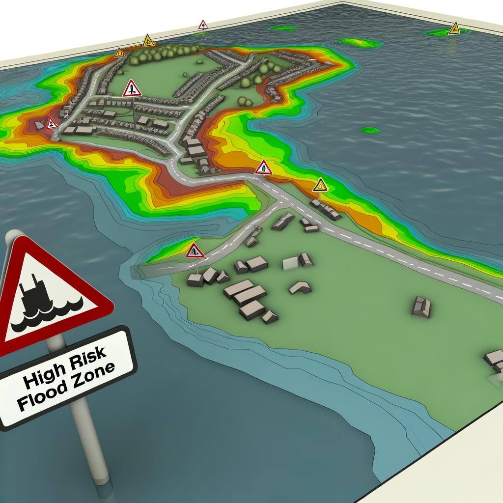
Flood zone designations are crucial in understanding the specific risk levels associated with different areas. These designations are provided on the Flood Insurance Rate Map (FIRM), which is essential for property owners.
Special Flood Hazard Areas
– Flood Zone A: Areas with a 1% annual chance of flooding, also known as the 100-year flood area.
– Flood Zone AE: Similar to Zone A but with base flood elevations determined.
– Flood Zone V: Coastal areas with additional flood hazards due to storm waves.
Non-Special Flood Risk Areas
– Flood Zone X: Areas with minimal flood risk, typically outside the 500-year flood area.
Key Symbols and Terms
Understanding key symbols and terms on flood maps helps you better interpret the data.
– Floodways: Channels of a river or stream and adjacent areas that must be kept free of encroachment to ensure that the 1% annual chance flood can be carried without substantial increases in flood heights. These can be found on the flood insurance rate map (FIRM) and flood hazard boundary map.
– Floodplains: Areas susceptible to being inundated by water from any source.
– 100-Year Flood Area: Areas with a 1% annual chance of flooding.
Why Flood Zones Alone Don’t Tell the Whole Story
While flood zone maps are a valuable tool, they don’t give the full picture of flood risk. Here’s why understanding the complete flood risk score is vital:

– All Areas Can Flood: Flooding isn’t limited to high-risk zones. Heavy rain, storm surges, and other factors can cause flooding in areas not typically considered at risk like Lake Oconee, lake Sinclair, lake Lanier, or Lake Blackshear. Many of these flooded areas don’t qualify for federal disaster assistance.
– Changing Environments: Urban development, changes in land use, elevation information, and climate change can alter flood risks over time. A property once considered low-risk may face increased danger.
– Incomplete Data: Flood maps are updated periodically, but they may not reflect the latest environmental changes or recent flooding events.
Tools for a Comprehensive Flood Risk Assessment
To get a complete understanding of your flood risk or flood risk snapshot use advanced tools like the Flood Insurance Guru’s risk assessment tool and RiskFactor.com. These resources provide detailed, personalized flood risk scores based on various factors, not just the FEMA flood zone designations.
Accessing Georgia Flood Zone Maps
Online Resources
You can access Georgia flood zone maps through various online resources like the FEMA Flood Map Service Center and the Georgia Flood MAP Program website. These tools provide comprehensive flood risk data and risk assessments.
Local Government Offices
For personalized assistance, local government offices and community officials, including floodplain administrators, can help you navigate floodplain management regulations and provide the latest news on map revisions.
Interpreting Flood Risk Levels
High-Risk Areas (Zone A and AE)
High-risk areas have a significant chance of flooding and require flood insurance. The National Flood Insurance Program (NFIP) mandates flood insurance requirements for properties in these zones, impacting 30-year mortgage agreements.
Moderate-to-Low Risk Areas (Zone X)
While these areas have lower flood risks, homeowners should still consider flood insurance due to potential flood damage.
Coastal High Hazard Areas (Zone V)
Coastal Georgia, including areas along the Savannah River, faces unique flood risks due to storm surges and waves.
Preparing for Flooding in Georgia
Flood Insurance
Flood insurance is crucial for protecting against flood losses. Policyholders should understand their coverage options and requirements under the National Flood Insurance Program (NFIP) and private flood insurance companies.
Evacuation Plans
Developing a robust evacuation plan is vital for safety during flood events. Stay informed about Federal Emergency Management Agency (FEMA) guidelines and state agencies’ directives.
Flood-Proofing Your Property
Flood-proofing measures can mitigate damage, such as elevating buildings and using flood barriers. The Georgia Department of Natural Resources provides resources for property owners to implement these measures.
Case Studies: Impact of Flooding in Georgia
Historical Flood Events
Georgia has experienced significant flood events in various locations, highlighting the importance of understanding and preparing for flood risks. Some notable events include:
– Saint Simons: Frequent flooding due to storm surges and high tides, impacting local homes and businesses.
– Savannah: Historical floods along the Savannah River particularly from hurricanes, causing extensive damage to coastal properties.
– Augusta: The 1990 flood was caused by heavy rainfall, leading to significant property damage and displacement.
– Macon: The 1994 flood resulted from Tropical Storm Alberto, which caused widespread flooding and damage from the Ocmulgee River.
– Atlanta: The 2009 floods saw record-breaking rainfall, leading to severe flooding across the city from areas like the Flint River, Yellow River, and Alcovy River.
– Columbus: Flooding events along the Chattahoochee River, affecting residential and commercial areas.
Understanding these historical events helps risk assessments and preparation, emphasizing that flood risks are not confined to high-risk zones.
Community Responses
Community responses, including the Community Rating System (CRS), improve floodplain management and can lower flood insurance premiums for residents.
Frequently Asked Questions
What is a 100-Year Flood?
A 100-year flood refers to a flood event with a 1% annual chance of occurring. It is a common term used in floodplain management and risk assessments.
How Often Are Flood Maps Updated?
Flood maps are periodically updated with a flood insurance study to reflect new data and changes in land use. These flood map changes make sure new buildings being built are following these updated floodplain regulations. These updates are critical for maintaining accurate flood risk information.
Will a FEMA Elevation Certificate Change My Flood map
An elevation certificate can change your flood map if it shows the structure is above the base flood elevation. This process is called a letter of map amendment.
Importance of Staying Informed
Staying informed about flood risks and floodplain management ordinances is essential for property and business owners. Utilizing resources like the Flood Map Viewer and maintaining contact with floodplain officials ensures you are prepared for potential flood events.
Resources for Further Information
For more detailed information, visit the FEMA Flood Map Service Center, Georgia Flood MAP Program, and local government offices. These resources provide comprehensive floodplain information and support.
Understanding the Georgia flood zone map was a turning point in my home-buying journey. It allowed me to make informed decisions and ensure my property was adequately protected against flood risks. By leveraging the tools and resources available, you too can navigate this complex landscape and secure your property against future flood events.

Information contained on this page is provided by an independent third-party content provider. This website make no warranties or representations in connection therewith. If you are affiliated with this page and would like it removed please contact editor @producerpress.com