Navigating Kentucky Flood Zones: A Comprehensive Guide
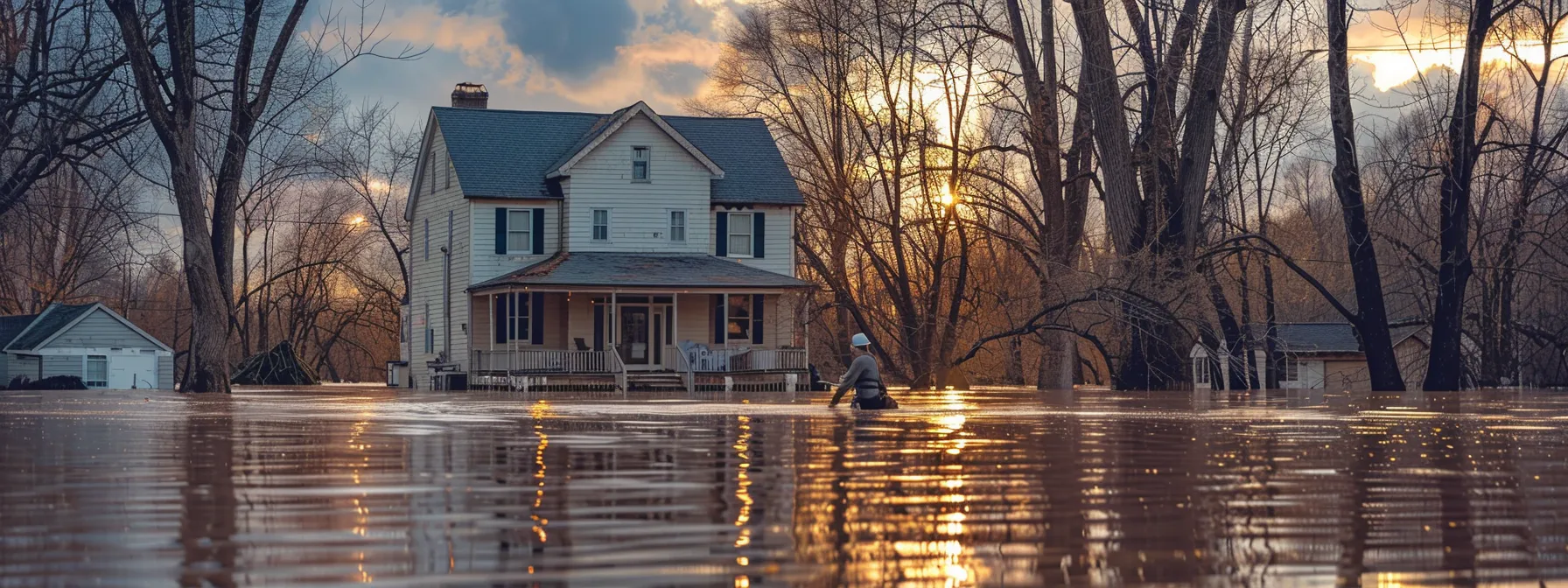
Living in Kentucky presents its own set of challenges when it comes to dealing with water-induced havoc. As a proud member of the community, it’s fundamental to understand how flood zones impact you, particularly concerning home insurance and, more broadly, your financial well-being. Floods don’t just bring water; they carry a torrent of complications that can soak the unprepared homeowner in more than just rising streams.
Keep reading to uncover the crucial strategies that will sustain your peace of mind against an unpredictable tide—knowing that the right insurance insights and proactive measures could be the difference between staying afloat and financial distress. Let this be your map through murky waters.
.png?width=1280&height=720&name=NEW%20Thumbnail%20(6).png)
Understanding the Basics of Kentucky Flood Zones
Grasping the significance of flood zones is pivotal for your security as a Kentucky homeowner, especially as weather patterns evolve and incidents of severe storms increase. Flood zones, determined by the Federal Emergency Management Agency (FEMA), demarcate regions according to their likelihood to flood. Recognizing these classifications guides your understanding of the risks related to water rising from a dam failure, overflowing due to heavy snow melt, or excessive rainwater unable to be managed by existing flood control systems.
Indeed, the unique contour of the land you reside on can either amplify or mitigate these risks, and with the looming concerns of climate change reshaping precipitation trends in Kentucky, staying informed about your area’s susceptibility to flooding becomes even more critical. By familiarizing yourself with FEMA’s flood zone labels, you can take proactive measures to secure your property and manage any emerging financial risks.

What Are Flood Zones and Why They Matter
Flood zones are critical to understand as they directly correlate to the risk levels your property faces from water-related disasters. Given Kentucky’s variable climate, with its propensity for heavy rain, a home situated near a river or in a low-lying area could be at higher risk for flooding. This risk assessment is not just about safeguarding your physical property; it bears financial implications that can affect your mortgage as lenders often require flood insurance in high-risk zones.
The National Flood Insurance Program (NFIP) is designed to offer homeowners in communities participating in the program access to flood insurance, which is fundamental in regions prone to inundation. Acknowledging whether your residence lies within a designated flood zone shapes the insurance coverage you need to protect your investment. It’s crucial you understand the different classifications of flood risk because they influence insurance requirements and premiums, ensuring that you are adequately prepared for the unforeseen.
Breaking Down the FEMA Flood Zone Classifications in Kentucky
Discerning which FEMA flood zone your property falls into can significantly affect the details of your insurance policy. For instance, living within a designated floodplain near the winding courses of the Ohio may mean higher insurance premiums, reflecting an increased probability of flooding. Awareness of these designations, informed by data from agencies like the National Oceanic and Atmospheric Administration, is fundamental in navigating your insurance needs.
If your home clings to the slopes of a Kentucky mountain, you might believe you’re safe from the high-risk flood zones that impact areas nearer to water bodies. However, unexpected topographical vulnerabilities may still place you within a zone where enhanced insurance coverage is advisable. Your due diligence in determining your exact flood risk is imperative in ensuring that your insurance policy delivers peace of mind and robust protection against the elements.

The Role of Topography in Defining Flood Risks
Your property‘s vulnerability to flooding isn’t just about proximity to the Ohio River or other bodies of water. Kentucky‘s diverse terrain means that elevation and the presence of structures such as levees can play pivotal roles in flood risk. Access to comprehensive data on these geographical and man-made features provides a clearer picture of your property‘s flood exposure.
Evaluating your property within the Kentucky landscape requires understanding the subtle ways that topography dictates water flow. Whether your home is nestled in the valleys or perched on higher ground can dramatically alter your need for flood insurance beyond the apparent risks associated with the Ohio River. Levees and other flood control systems are significant, but they are one piece of a complex topographical puzzle impacting your property‘s risk assessment.
How Climate Change Affects Kentucky Flood Zones
Climate shifts bear directly on Kentucky‘s waters, with rising temperatures affecting lake levels and altering flood zone maps in the process. As a homeowner, you should proactively seek updated information on these changes, notably if your property is adjacent to areas like the Eastern Kentucky Coalfield, thereby ensuring your flood insurance coverage remains relevant and comprehensive.
Neighboring states, such as North Carolina and Indiana, also encounter climate-induced alterations in their flood zone demarcations, signaling a regional trend that might affect water flow and flood risks in your Kentucky locale. Staying alert to these developments is critical, as they can influence both the environmental landscape of your community and the insurance market, potentially adjusting your flood risk profile and policy requirements.
Strategies for Navigating Flood Risks in Kentucky
As floodwaters do not respect state boundaries, it is clear that the risks faced by a Kansas farmstead can closely mimic those of your Kentucky residence. Assessing your property‘s flood risk becomes a vital step that goes hand in hand with safeguarding against the financial strain of disasters. From identifying local elevation surges akin to California‘s famous hills, which may provide a false sense of security, to acknowledging the flat expanses that increase vulnerability, your understanding of the terrain is critical.
Equally essential is implementing flood defenses, akin to using battens against storms in coastal regions. Slating time to reinforce your home can make all the difference in protecting your assets. Similarly, ensuring your flood insurance is robust and responsive means staying attuned to adjustments in policy that reflect an ongoing assessment of risk, much like staying abreast with news from the Courier Journal for the latest updates.
Finally, leveraging technology for real-time flood monitoring can be as pivotal to your emergency preparedness as having backup electricity generators during an outage. By remaining vigilant, you position yourself to adeptly manage both the expected and unexpected challenges of flood risks.
Essential Steps to Assess Your Property‘s Flood Risk
To properly assess your property‘s risk of flooding, you must consider its position within the drainage basin. If your home lies near tributaries that feed into the Gulf of Mexico you’re part of a massive watershed where rainfall hundreds of miles away can have a downstream impact, raising local water levels and increasing the potential hazard to your property.
Engaging with local emergency management officials can provide invaluable insights into flood risks specific to your area. Not only can they offer historical data, but their resources might help you understand patterns of water flow and rising levels that could threaten your safety, similar to cautionary measures taken against floods in Virginia.
|
Step |
Action |
Purpose |
|---|---|---|
|
1 |
Examine drainage basin proximity |
To understand the wider watershed influence on local flood risk |
|
2 |
Consult with emergency management |
To gain expert insights into regional flood patterns and hazards |
Implementing Flood Defenses and Mitigation Measures
Adopting proactive flood defenses is paramount, akin to Colorado‘s approach to wildfire mitigation. By installing sump pumps and backflow valves, you effectively minimize potential damage guided by the knowledge that a tropical cyclone‘s rainfall could impact your region. Crafting a flood response plan that accounts for such variable weather patterns builds resilience, ensuring your policy adapts to Kentucky‘s unique challenges.
When you consider that Connecticut‘s strategies against nor’easters involve comprehensive zoning and land-use planning, it becomes clear that similar foresight is essential in Kentucky, with precipitation trends posing consistent threats. Thus, reinforcing your property with elevated structures and flood barriers is as indispensable as the policy that offers financial protection—this is your shield against the unexpected deluge, securing your home against the caprices of nature.
Understanding and Purchasing Appropriate Flood Insurance
Securing proper flood insurance requires that you bridge your understanding of local flood zones with the protections necessary to safeguard your home. Furnishing your strategy with data from resources such as the United States Geological Survey, whose comprehensive database includes crucial information on streams and waterways across Kentucky, is an astute beginning. These tools help articulate the specific flood risks your property may encounter, similar to the ways Missouri homeowners evaluate their own flood challenges.
Consequently, examining the nuances of your insurance plan to ensure it comprehensively addresses these risks is vital. Take into account the streamflow data and flood predictions facilitated by agencies like the United States Geological Survey to affirm that your insurance safeguards align with the dynamic and sometimes unpredictable nature of floods in Kentucky. Your initiative in this regard is a proactive measure that fortifies your financial resilience against the impacts of natural disasters.
Utilizing Technology for Real-Time Flood Monitoring
Embracing technology‘s advancements empowers you to monitor flood threats with remarkable precision. Louisville Metro, for example, benefits from innovative heat mapping and water level gauging that detects potential flooding, giving residents a critical time advantage to enact their safety plans and review insurance policies before severe weather, be it a torrential downpour or a tornado, strikes.
Utilization of real-time flood monitoring systems becomes essential, especially in areas mirroring Louisiana‘s flood-prone regions. These systems provide up-to-the-minute data that not only enhance preparedness but also inform the appropriate adjustments to insurance policies, ensuring that coverage remains adequate against the dynamic backdrop of climate unpredictability.
Impact of Flood Zones on Property and Insurance in Kentucky

Unveiling the multifaceted relationship between flood zones and property dynamics in Kentucky, you embark on a pivotal chapter in home ownership. Floods have a discernible impact on property values, a reality that can be as pressing in the lush valleys of Kentucky as it is in the coastal areas of San Diego or the dense urban landscapes of New Jersey. As you navigate the flood insurance landscape, understanding the varied implications of residing in flood-prone areas is essential.
It is not merely about policy procurement, it’s also about mastering the process of filing and managing flood insurance claims should waters rise. Whether you’re considering the National Flood Insurance Program, private flood insurance options, or extra layers of protection with excess flood insurance coverage, each choice requires careful deliberation.
Similar to residents facing flash flood threats in Arizona, your journey to safeguard your Kentucky property is as much about risk management as it is about financial prudence.
How Flood Zones Influence Property Values in Kentucky
Property values in Kentucky are intertwined with flood zone designations, which can be as critical to a home’s marketability as its architecture or neighborhood. A county with properties in a high-risk flood zone might see reduced demand and value, as potential buyers weigh the added costs and risks against their investment. This is compounded by the fact that, unlike Tennessee‘s rocky topography or the hilly terrains of West Virginia, some Kentucky regions are particularly susceptible to climate-induced flash floods, exacerbating these concerns.
|
Impact Factor |
Property Value Correlation |
Buyer Concerns |
|---|---|---|
|
Flood Zone Designation |
High-risk areas may see depreciation |
Long-term risks and insurance costs |
|
Regional Climate Changes |
Sensitivity to flash flood risks can affect marketability |
Potential frequency and severity of flooding events |
As climate patterns shift, the frequency and intensity of flash floods are on the rise in Kentucky, with direct implications for homeowners and property values. These changes warrant a heightened level of vigilance for a home’s flood preparedness, which often leads to additional investments in infrastructure and insurance—factors that can deter potential buyers and influence property valuations. This dynamic creates a ripple effect on housing markets, with prospective homebuyers in Kentucky scrupulously evaluating flood risks as part of their decision-making process.
Navigating the Flood Insurance Landscape
When you confront the reality of navigating the flood insurance landscape in Kentucky, you face a terrain marked by the possibility of natural disaster. As you traverse this environment, it’s essential to weigh the risks of drought and flood equally, ensuring your coverage is comprehensive for any eventuality.
Consider the experiences of homeowners in Pennsylvania and Michigan, states known for their unpredictable weather; they often utilize resources such as flood insurance rate maps offered in PDF form to understand their risk levels better. Using these tools, you can cast a wider safety net over your home, making an informed choice that aligns with the unique challenges presented by Kentucky‘s geographic diversity:
|
Natural Disaster |
Risk Assessment |
Resource |
|---|---|---|
|
Flooding |
Review flood insurance rate maps |
Flood maps (PDF) |
|
Drought |
Ensure coverage for all water-related events |
Insurance policy details |
The Process of Filing and Managing Flood Insurance Claims
When faced with the aftermath of a flood, navigating federal bureaucracy can be as challenging as understanding the unpredictability of the event itself. Initiating the process begins with reporting your claim to the insurance agent who documented your policy; this step is critical for setting into motion the sequence of actions needed to assess and mitigate the damages incurred. The United States Census Bureau data on Kentucky‘s housing stability underlines the necessity for a streamlined claims procedure, particularly for communities still reeling from climate change‘s impact on weather patterns.
As you advance your claim, you become inextricably linked to a network of professionals responsible for evaluating and substantiating the loss to your property. This collaboration can mirror the efforts seen in places such as South Carolina or Oklahoma, where communities frequently navigate the consequences of severe weather. The difference now, however, is that climate change and its sting, which reaches even beyond the borders of Mexico, has introduced a new level of complexity to these scenarios.
|
Stage |
Task |
Responsibility |
|---|---|---|
|
Initial |
Claim Reporting |
Homeowner to Insurance Agent |
|
Subsequent |
Damage Assessment |
Claims Adjuster Review |
National Flood Insurance Program
If floodwaters from the Great Lakes or severe storms during the Kentucky Derby season leave you grappling with damages, the National Flood Insurance Program (NFIP) can be your financial bulwark. By enrolling in the NFIP, you gain access to a standardized policy designed to cover the costs of rehabilitating your property after a devastating flood event, ensuring your home’s resilience against the elements you’ve grown to expect.
As you consider the specific demands of construction in flood-prone territories, the NFIP becomes an essential component of your risk management plan. Visit the program’s official URL to discover the range of coverage options and to understand how federal support can help mitigate the financial aftermath of flood damages to your Kentucky dwelling.
Private Flood Insurance
Stand beyond the offerings of public programs and explore private flood insurance when charting your property‘s defense against water‘s whims. The specificity of a “flood insurance rate map” can reveal unique vulnerabilities, peculiar to Kentucky‘s coal-rich veins, where poverty may already be a battle. Private insurers tailor coverage to such terrains, granting robust peace of mind, even as the rumble of a distant thunderstorm threatens.
Your quest for comprehensive coverage can lead to private flood insurance alternatives not constrained by the NFIP’s boundaries, offering flexibility to Kentucky homeowners in safeguarding their assets. This option proves invaluable, particularly when your home lies outside high-risk flood zones indicated on flood maps, or in locales like Georgia, where flood insurance requisites might differ, ensuring your protection is broad, covering even the most unexpected flood events.
Excess Flood Insurance Coverage
Considering the lessons from regions like Nevada, where water levels in reservoirs can drastically affect local flood risks, excess flood insurance coverage goes beyond standard policies. If your Kentucky home on the banks of the Cumberland River is subjected to extraordinary flood events, excess insurance acts as a critical safeguard, providing financial protection that standard policies may not fully encompass.
When standard coverage reaches its limits, excess flood insurance ensures you’re prepared for severe inundations, a necessity understood by homeowners in areas like Pittsburgh, where rivers can swell beyond expected boundaries. It’s an essential layer of assurance, much like Oregon‘s rigorous floodplain management, protecting from losses that might otherwise be devastating.
|
Region |
Local Flood Risk Factor |
Insurance Consideration |
|---|---|---|
|
Nevada |
Reservoir water levels |
Extra coverage for reservoir overflow |
|
Kentucky (Cumberland River) |
Riverbank location |
Excess insurance for extraordinary events |
|
Pittsburgh |
Swelling rivers |
Additional insurance for severe flood events |
|
Oregon |
Floodplain exposure |
Comprehensive floodplain management integrated with insurance plans |
Legal and Regulatory Considerations in Flood Zones
As you consider establishing, renovating, or purchasing a mobile home in Kentucky, understanding the region’s floodplain management regulations is imperative. These policies govern land use in flood-prone areas and are designed to mitigate the risk of damage from ice jams, seasonal floods, and severe weather. With the Mississippi River influencing regional water levels and climate considerations, comprehensive research into local zoning laws and building codes becomes crucial to secure your investment.
Navigating the convoluted terrain of legal obligations and rights within these zones not only helps you remain compliant but also equips you with the knowledge to maximize safety and minimize potential loss.
Ensure that your steps forward are on solid legal ground, especially as you maneuver through the complexities that flood zones bring to the terrain of property ownership and development in Kentucky.
Kentucky‘s Floodplain Management Regulations
In Kentucky, floodplain management encompasses the careful regulation of areas vulnerable to flooding, a necessity in a state where mining activities can exacerbate the risk of waterway obstruction and subsequent flooding. These regulations are keenly focused on maintaining a balance between environmental stewardship and economic development, particularly in regions that could potentially be designated as disaster areas.
Learning from the experiences of other states, such as Arkansas with its rigorous floodplain management and Alaska‘s precautions against natural disaster impacts, Kentucky enforces policies to minimize flood damages. These policies dictate specific building requirements and development restrictions in recognized flood zones and aim to uphold community safety and resilience in the face of potential flooding events.
|
Region |
Key Consideration |
Regulatory Action |
|---|---|---|
|
Kentucky |
Mining Influence on Flood Risks |
Balance environmental and development needs |
|
Arkansas |
Rigorous Floodplain Management |
Implement stringent building codes |
|
Alaska |
Precautions Against Disasters |
Enforce development restrictions |
Zoning Laws and Building Codes for Flood-Prone Areas
Understanding the nuances of zoning laws and building codes specific to flood-prone areas is essential for your property‘s longevity and legality. Similar to Alabama‘s strictures which lock in standards to withstand flooding, Kentucky imposes its own regulations that demand attention. As you plan your property‘s layout and structure, consider how such local ordinances, parallel to New Jersey‘s coastal construction codes, will shape your project.
Codes in Kentucky are informed by a legacy of flooding events, and observing these can be as critical as those enforced in San Francisco‘s earthquake zones. It’s essential for these safety measures to be incorporated into your building plans. Your adherence to these codes ensures your home’s stability and market value, just as properties in New Hampshire must meet specific criteria to address their unique environmental challenges.
Navigating Legal Obligations and Rights in Flood Zones
Understanding your legal obligations and rights within Kentucky‘s flood zones is tantamount to protecting your residence, particularly if you’re keen on issues like affordable housing. Census data can aid in grasping regional demographics and the distribution of flood zones, which in turn informs the legal parameters for proper land use and insurance requirements. It’s essential to be well-versed in these aspects, as they can substantially impact the long-term sustainability and affordability of housing in flood-prone areas.
As you secure your home against nature’s whims, consider lessons from areas like New Mexico and Wisconsin, where flood management practices and legal frameworks have been tailored to regional needs. Similarly, in states like Delaware, navigating statutory requirements associated with flood zones guides homeowners through the complex web of legalities linked to flood insurance and property rights. This vigilance ensures your Kentucky dwelling adheres to all necessary regulations, fostering security in your investment and living environment.
Resources and Assistance for Flood Zone Navigation

As you maneuver through Kentucky‘s diverse landscapes, from coal mining areas prone to waterway blockages to regions at risk of weather-induced disasters, accessing the right resources and assistance is key to effective flood zone navigation.
While technology offers innovative tools for flood risk management – akin to the systems in place in Maryland for storm surge tracking or the cutting-edge disaster recovery strategies employed in Illinois – understanding how to leverage these state-of-the-art resources remains paramount. Seek out the federal and state flood zone information designed to aid property owners like you.

Engage with professionals who provide precise flood zone analysis and crafted planning suited to Kentucky’s unique topography. Moreover, don’t overlook the value of community support systems that are essentially a collective bulwark against the rigors of flood risk management. It’s through this networked approach that you’ll fortify your home against the tides of uncertainty.
Leveraging Federal and State Flood Zone Resources
Efficient risk management in Kentucky‘s flood zones requires taking advantage of both federal and state resources. The Federal Emergency Management Agency (FEMA) provides extensive flood hazard mapping, while the Storm Prediction Center offers insights specifically tailored for anticipating weather events that might precipitate flooding.
When it comes to your property‘s safety, understanding its elevation is key. State resources, including Kentucky‘s Division of Water, present a wealth of topographical data and floodplain analysis tools that enhance your ability to gauge specific flood threats to your home during the derby season and beyond:
|
Resource |
Description |
Benefit |
|---|---|---|
|
Federal Emergency Management Agency (FEMA) |
Flood Hazard Mapping |
Identifies potential flood areas |
|
Storm Prediction Center |
Weather Event Anticipation |
Provides early warnings for preparations |
|
Kentucky Division of Water |
Topographical Data and Floodplain Analysis |
Assists property-specific risk assessment |
Finding Professional Guidance for Flood Zone Analysis and Planning
Seeking expert advice to decode the intricacies of flood zones can be as essential to your Kentucky property as a stable foundation. Enlist the services of accredited floodplain managers or civil engineers, professionals equipped with the expertise necessary to analyze your property’s specific flood risk and offer tailored mitigation strategies.
By collaborating with these seasoned specialists, you embrace a proactive stance, fortifying your home with data-driven, site-specific planning that transcends generic recommendations. They’ll navigate you through the local floodplain regulations, ensuring your preparedness aligns seamlessly with Kentucky‘s unique environmental challenges.
Community Support Systems for Flood Risk Management
In your journey to safeguard your Kentucky home from the perils of flooding, don’t underestimate the power of local knowledge. Community support systems, often comprised of neighbors who have navigated similar challenges, serve as a wealth of practical advice and may offer local tips that official resources might miss.
Connect with civic groups and local organizations dedicated to flood risk education and management. These entities often work on the ground to strengthen community resilience and can provide you with assistance tailored to the specific needs and experiences of your Kentucky locale.
Future Outlook: Adapting to Changing Flood Zones in Kentucky

As you gaze toward the horizon, you must prepare for the inevitable shifts in Kentucky‘s flood zones, propelled by the relentless tide of climate change. Projections indicate that rising temperatures and altered weather patterns will redefine the aquatic landscapes of your beloved state, necessitating innovative management and mitigation strategies to cope with these changes.
On the policy front, you can anticipate a wave of adaptations, with infrastructure improvements aimed at increasing flood resilience. Your role in this evolving narrative is active, as staying informed and adapting to policy changes will be critical in safeguarding your property against the morphing flood maps of the future.
Projected Shifts in Flood Zones Due to Climate Change
As Kentucky‘s climate patterns fluctuate, expect to see variations in flood zone boundaries. Increased precipitation and rising water levels may expand high-risk areas, while drought conditions could shift these zones unexpectedly, creating new risk landscapes for homeowners and insurers alike.
Technological advancements and environmental studies will be essential in forecasting these changes, allowing for more agile and informed adaptation strategies. Keeping pace with updated flood zone maps and real-time climate data will be vital in mitigating your property‘s risk and responding effectively to evolving environmental and insurance landscapes.
|
Factor |
Impact on Flood Zones |
Homeowner Considerations |
|---|---|---|
|
Increased Precipitation |
Expansion of High-Risk Areas |
Review and update insurance policies |
|
Drought Conditions |
Shifting of Flood Zone Boundaries |
Re-evaluate property risk assessments |
|
Climate Data |
Informing Adaptation Strategies |
Stay abreast of environmental changes |
Innovations in Flood Management and Mitigation
Your role as a homeowner in identifying and implementing flood management innovations is intrinsic to your property‘s longevity. Embracing advanced hydrological forecasting systems that predict flood events with greater accuracy can significantly boost your preemptive measures, diminishing potential damages and allowing you to react swiftly to oncoming threats.
In parallel, integrating green infrastructure into your property management practices serves both as a sustainable approach and a robust buffer against water damage. Techniques such as rain gardens and pervious pavements work to manage excess water naturally, lessening the reliance on traditional water removal systems and contributing to a resilient living environment.
Policy Changes and Infrastructure Improvements to Enhance Flood Resilience
Recognizing the dynamic nature of flood zones in Kentucky, policy changes are in motion to enhance resilience. Legislators are actively working to update zoning laws to reflect the changing realities on the ground, ensuring that new building codes and land use regulations account for the latest flood risk data and climate change projections.
Concurrently, infrastructure improvements are being prioritized to better protect Kentucky communities from flood damage. Investments in flood barrier systems, waterway management, and drainage upgrades are examples of initiatives designed to effectively contain and divert floodwaters, safeguarding neighborhoods and livelihoods:
|
Initiative |
Description |
Expected Impact |
|---|---|---|
|
Flood Barrier Systems |
Installation of levees and floodwalls |
Enhanced protection for at-risk communities |
|
Waterway Management |
Clearing and maintenance of streams and rivers |
Improved flow and reduction of blockage risks |
|
Drainage Upgrades |
Expanding and modernizing stormwater systems |
Increased capacity to handle heavy rain events |
Frequently Asked Questions
What defines a flood zone in Kentucky?
In Kentucky, a flood zone is an area designated by FEMA based on its risk of flooding, which influences building regulations and insurance requirements.
How do I determine my property’s flood risk level?
To assess your property‘s flood risk in Kentucky, utilize FEMA’s Flood Map Service Center to locate your area on the official flood maps; this will indicate your flood zone classification.
Will living in a flood zone affect my insurance premiums?
Absolutely, residing in a designated flood zone typically results in higher flood insurance premiums due to an increased risk of flooding and related damage.
What are Kentucky’s requirements for flood insurance?
In Kentucky, homeowners with federally backed mortgages in high-risk flood zones must purchase flood insurance, typically through the National Flood Insurance Program (NFIP).
Where can I find resources for flood zone assistance in Kentucky?
For flood zone assistance in Kentucky, consult FEMA’s Flood Map Service Center, Kentucky Division of Water, and your local government for the most accurate and up-to-date resources.
Conclusion
Navigating Kentucky‘s flood zones is crucial for maintaining the safety and value of your property due to the state’s diverse and changing climate conditions. Understanding FEMA flood zone classifications and investing in appropriate flood insurance is essential for Kentucky homeowners to mitigate financial risks associated with water-related disasters.
Staying informed on local floodplain regulations, zoning laws, and leveraging community and technological resources can greatly enhance flood preparedness and resilience.
As environmental patterns evolve, proactive engagement with policy changes and infrastructure improvements is key to adapting to the shifting flood risk landscape in Kentucky.
Information contained on this page is provided by an independent third-party content provider. This website make no warranties or representations in connection therewith. If you are affiliated with this page and would like it removed please contact editor @producerpress.com